However in the age of technology we do things a little different now. We use the UAV, Unmanned aerial vehicle.
Planning a route which takes in to account the project managers specifications we offer very detailed vertical images from a height from ground level to, in-fact, any height up to 126mts AGL. Images which are not achievable from the standard Cessna or Robinson 44 due to aircraft construction, wheels, spats struts, got in the way, never mind the low fly rule. If 45* obliques are required its only a matter of adding an additional photography task at each waypoint.
The UAV flight is silent, so no noise complaints from residents and the results, quick and accurate.
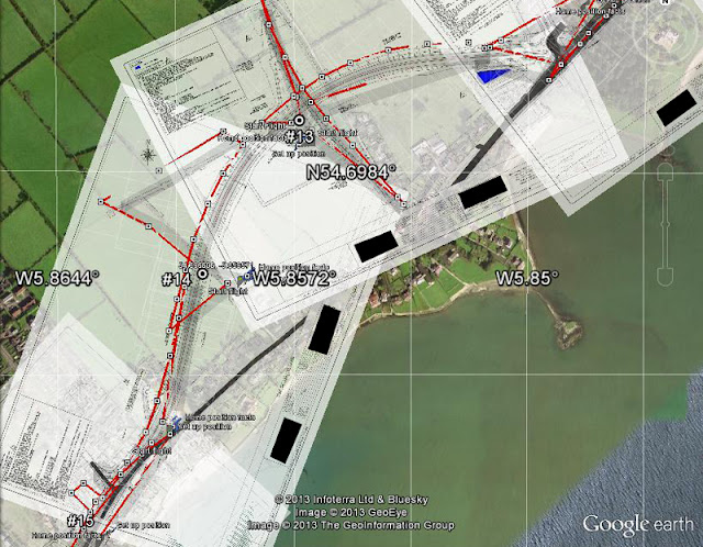
At the planning stage our maps are over-layed with the constructors/surveyor detailed plans, using very sophisticated software and from there a flight plan can be designed, which takes into account buildings bridges footpaths etc. The UAV course will be exactly the same for each and every-time we are required to revisit making progress locations exactly the same.
On site, the flight is conducted by our CAA / IAA qualified staff with the minimum of disruption. During the post processing highly detailed images are stitched together to form an aerial plan view of the construction site.
 |
| Full 4K route |
 |
| Close up of area |
Now you have no excuse to have those highly detailed vertical images at a cost which is affordable.
For a free quotation please do discuss the flight with our staff.
No comments:
Post a Comment